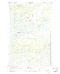
1968 Map of Birchdale SW
USGS Topo · Published 1987About this map
Pine Island State Forest and the Red Lake Indian Reservation define this remote northern landscape near the Canadian border. The 1968 topography, based on photogrammetric methods from 1966, reveals a complex network of wetlands and drainage patterns including McCloud Creek and the Wing River. The map captures a moment before modern infrastructure, where seasonal access via the Winter Trail was essential for navigating the forest and reservation lands.
Find a feature on this map
11 named features on this map. Tap any name to fly to it.
Don’t see what you’re looking for? This feature index may not catch every label — zoom into the map to look around manually.
Map Details
Editions of this 1968 Birchdale SW Map
2 editions found
Other maps of this area

1919 · Birchdale
USGS Topo · 1:62,500

1919 · I
USGS Topo · 1:62,500

1954 · Roseau
USGS Topo · 1:250,000

1957 · Roseau
USGS Topo · 1:250,000

1958 · Roseau
USGS Topo · 1:250,000

1968 · Birchdale SW
USGS Topo · 1:24,000

1968 · Birchdale SE
USGS Topo · 1:24,000

1968 · Stratton
USGS Topo · 1:24,000
1968 · Birchdale
USGS Topo · 1:24,000

1968 · Border
USGS Topo · 1:24,000