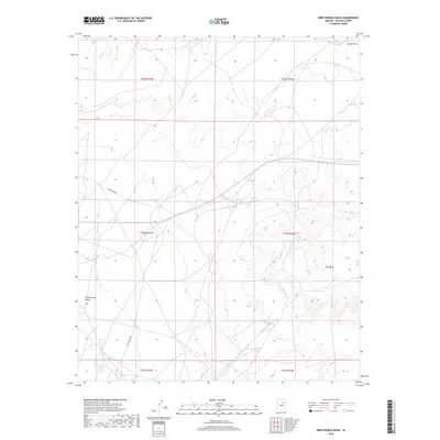
2018 Map of Bird Springs Wash
USGS Topo · Published 2018About this map
Coyote Wash cuts across the northern edge of this high-desert terrain within the Fort Defiance Agency jurisdiction in Navajo County. The landscape is defined by the ephemeral flow of the wash and the namesake Bird Springs, which provide critical reference points in an area of minimal settlement. The drainage patterns and topography documented by the U.S. Geological Survey illustrate the subtle elevation shifts across the southwestern plateau. This map reveals the intricate network of local roads and routes that serve the region, showing how transportation follows the natural contours of the land around seasonal water sources.
Find a feature on this map
2 named features on this map. Tap any name to fly to it.
Don’t see what you’re looking for? This feature index may not catch every label — zoom into the map to look around manually.
Map Details
Editions of this 2018 Bird Springs Wash Map
This is the sole edition of this map. No revisions or reprints were ever made.
Other maps of this area
1883 · Tusayan
USGS Topo · 1:250,000
1886 · Tusayan
USGS Topo · 1:250,000

1947 · Flagstaff
USGS Topo · 1:250,000
1954 · Winslow
USGS Topo · 1:62,500
1954 · Winslow 4 NW
USGS Topo · 1:24,000
1954 · Winslow 4 NE
USGS Topo · 1:24,000
1954 · Flagstaff
USGS Topo · 1:250,000
1955 · Leupp
USGS Topo · 1:62,500
1957 · Winslow 1 SW
USGS Topo · 1:24,000
1957 · Winslow 2 SE
USGS Topo · 1:24,000