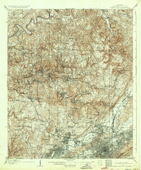
1906 Map of Birmingham Coal District
USGS Topo · Published 1934About this map
Industrial expansion and coal extraction define this early 20th-century landscape northwest of Birmingham. The map reveals a dense network of mining operations and company towns, such as Banner Mines and Brookside, which grew alongside the Southern RR and other vital rail lines. These railways, including the Kansas City Memphis and Birmingham RR, served as the economic backbone for settlements like Pratt City and Wylam, transporting coal from operations like Kosmo Mines and Thompson Mine.
Find a feature on this map
94 named features on this map. Tap any name to fly to it.
Don’t see what you’re looking for? This feature index may not catch every label — zoom into the map to look around manually.
Map Details
Editions of this 1906 Birmingham Coal District Map
4 editions found

Other maps of this area

1889 · Birmingham
USGS Topo · 1:125,000

1890 · Bessemer
USGS Topo · 1:125,000

1892 · Birmingham
USGS Topo · 1:125,000

1892 · Bessemer
USGS Topo · 1:125,000

1893 · Jasper
USGS Topo · 1:125,000

1895 · Birmingham
USGS Topo · 1:125,000

1899 · Brookwood
USGS Topo · 1:125,000

1904 · Birmingham Coal District
USGS Topo · 1:62,500

1905 · Bessemer Iron District
USGS Topo · 1:62,500

1905 · Leeds
USGS Topo · 1:62,500