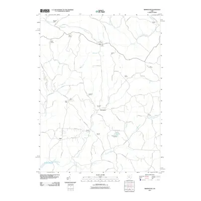
2010 Map of Birmingham
USGS Topo · Published 2010About this map
Birmingham and Peoli serve as central points in this rural landscape at the intersection of several fork-and-creek drainage systems. The settlement of Irish Ridge sits atop its namesake high ground, evidenced by the nearby Irish Ridge Cemetery. This 2010 topographic record highlights a region defined by its reliance on small water bodies and rural road networks, with names like Sugartree Fork and Rocky Fork snaking through the terrain. Genealogists will find considerable value in the numerous family and community burial sites scattered across the township, ranging from the Couts Family Cemetery in the north to the Darby Cemetery near the eastern border. To the south, the northern reaches of the Salt Fork Reservoir begin to take shape, while the Hickory Hollow Lake Dam manages more localized water resources near Odell.
Find a feature on this map
75 named features on this map. Tap any name to fly to it.
Don’t see what you’re looking for? This feature index may not catch every label — zoom into the map to look around manually.
Map Details
Editions of this 2010 Birmingham Map
This is the sole edition of this map. No revisions or reprints were ever made.
Other maps of this area

1909 · Antrim
USGS Topo · 1:48,000

1909 · Uhrichsville
USGS Topo · 1:62,500

1909 · Cambridge
USGS Topo · 1:62,500

1911 · Antrim
USGS Topo · 1:62,500

1911 · Uhrichsville
USGS Topo · 1:62,500

1911 · Newcomerstown
USGS Topo · 1:62,500

1912 · Cambridge
USGS Topo · 1:62,500

1913 · Newcomerstown
USGS Topo · 1:62,500

1943 · Newcomerstown
USGS Topo · 1:62,500

1951 · Canton
USGS Topo · 1:250,000