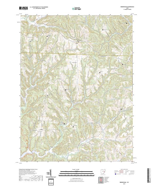
2023 Map of Birmingham
USGS Topo · Published 2023About this map
The border between Tuscarawas Co and Guernsey Co divides a landscape defined by the intricate branching of the Clear Fork and Rocky Fork. The settlement of Peoli sits atop the ridges in the north, while the small community of Odell is situated in the southwestern corner of the sheet. The area is notable for its unusually high density of burial sites and rural congregations, reflecting a deeply rooted settlement pattern. From the Couts Family Cem to the Irish Ridge Cem, these landmarks provide a clear genealogy of the families who established farms along the winding township roads. Moving south toward Sugartree Fork, the terrain transitions into more pronounced ridges like Irish Ridge and Colliers Hill. The hydrology of the region is punctuated by Hickory Hollow Lake, a man-made feature that interrupts the natural drainage of Turkey Run.
Find a feature on this map
100 named features on this map. Tap any name to fly to it.
Don’t see what you’re looking for? This feature index may not catch every label — zoom into the map to look around manually.
Map Details
Editions of this 2023 Birmingham Map
This is the sole edition of this map. No revisions or reprints were ever made.
Other maps of this area

1909 · Antrim
USGS Topo · 1:48,000

1909 · Uhrichsville
USGS Topo · 1:62,500

1909 · Cambridge
USGS Topo · 1:62,500

1911 · Antrim
USGS Topo · 1:62,500

1911 · Uhrichsville
USGS Topo · 1:62,500

1911 · Newcomerstown
USGS Topo · 1:62,500

1912 · Cambridge
USGS Topo · 1:62,500

1913 · Newcomerstown
USGS Topo · 1:62,500

1943 · Newcomerstown
USGS Topo · 1:62,500

1951 · Canton
USGS Topo · 1:250,000