
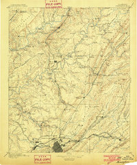
1895 Map of Birmingham
USGS Topo · Published 1895About this map
Birmingham stands as the industrial core of north-central Alabama in this 1887 survey, capturing the city during its rapid late-century expansion into a regional steel and iron powerhouse. The landscape is defined by the heavy infrastructure of the iron industry, featuring the Old Irondale Furnace and Sloss Quarry, alongside numerous extraction sites such as the Pratt Mines and Sloss Mine. The rail network, including the Louisville and Nashville Railroad and the Kansas City Memphis and Birmingham Railroad, radiates from the city center to serve outlying industrial satellites like Ensley and Thomas.
Find a feature on this map
185 named features on this map. Tap any name to fly to it.
Don’t see what you’re looking for? This feature index may not catch every label — zoom into the map to look around manually.
Map Details
Editions of this 1895 Birmingham Map
2 editions found
Other maps of this area

1885 · Gadsden
USGS Topo · 1:125,000

1888 · Cullman
USGS Topo · 1:125,000

1888 · Gadsden
USGS Topo · 1:125,000

1889 · Springville
USGS Topo · 1:125,000

1889 · Birmingham
USGS Topo · 1:125,000

1890 · Bessemer
USGS Topo · 1:125,000

1890 · Talladega
USGS Topo · 1:125,000

1892 · Cullman
USGS Topo · 1:125,000

1892 · Birmingham
USGS Topo · 1:125,000

1892 · Springville
USGS Topo · 1:125,000