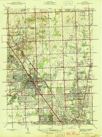
1945 Map of Birmingham
USGS Topo · Published 1945About this map
The Rouge River and the Grand Trunk Western railroad corridor shape the landscape of northern Oakland County during this mid-1940s survey. Rapid residential development is visible in Birmingham, where a dense grid of streets radiates from the city center, while surrounding areas like Bloomfield Hills and Troy maintain a more dispersed, transitionary character. The presence of numerous institutions, including the Little Flower High Sch and St Hugo Ch, alongside landmarks like Dodge Bros State Park No 6, reflects a period of significant community growth and civic investment.
Find a feature on this map
67 named features on this map. Tap any name to fly to it.
Don’t see what you’re looking for? This feature index may not catch every label — zoom into the map to look around manually.
Map Details
Editions of this 1945 Birmingham Map
This is the sole edition of this map. No revisions or reprints were ever made.
Other maps of this area

1905 · Wayne
USGS Topo · 1:62,500

1905 · Detroit
USGS Topo · 1:62,500

1907 · Pontiac
USGS Topo · 1:62,500

1908 · Rochester
USGS Topo · 1:62,500

1912 · Wayne
USGS Topo · 1:62,500

1918 · Detroit
USGS Topo · 1:62,500

1924 · Detroit
USGS Topo · 1:62,500

1934 · Detroit
USGS Topo · 1:62,500

1936 · Warren
USGS Topo · 1:31,680

1936 · Birmingham
USGS Topo · 1:31,680