
1906 Map of Birmingham Special
USGS Topo · Published 1906About this map
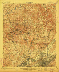
Industrial expansion in the Warrior Coal Field is the primary driver of the landscape depicted in this 1906 survey. The rail network is remarkably dense for the era, with the Southern Ry, Louisville and Nashville RR, and the Birmingham Mineral RR crisscrossing the terrain to serve a constellation of extraction sites like Banner Mines, Kosmo Mines, and Graves Mines. The map reveals the intricate social geography of early mining life, showing compact worker settlements such as Brookside, Blossburg, and Baileys Quarters positioned near the pits and drift mouths.
Find a feature on this map
131 named features on this map. Tap any name to fly to it.
Don’t see what you’re looking for? This feature index may not catch every label — zoom into the map to look around manually.
Map Details
Editions of this 1906 Birmingham Special Map
4 editions found
Other maps of this area

1889 · Birmingham
USGS Topo · 1:125,000

1890 · Bessemer
USGS Topo · 1:125,000

1892 · Birmingham
USGS Topo · 1:125,000

1892 · Bessemer
USGS Topo · 1:125,000

1893 · Jasper
USGS Topo · 1:125,000

1895 · Birmingham
USGS Topo · 1:125,000

1899 · Brookwood
USGS Topo · 1:125,000

1904 · Birmingham Coal District
USGS Topo · 1:62,500

1905 · Bessemer Iron District
USGS Topo · 1:62,500

1905 · Leeds
USGS Topo · 1:62,500