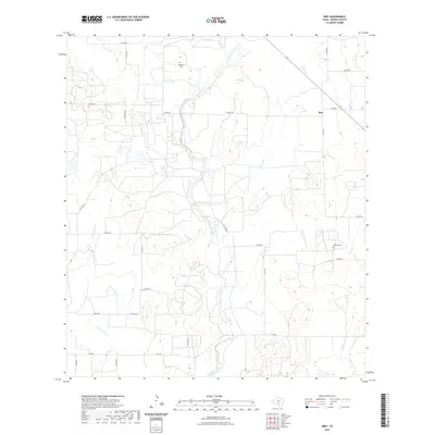
2022 Map of Biry
USGS Topo · Published 2022About this map
Hondo Creek carves a winding path through this central Medina County landscape, defining the local drainage patterns alongside Elm Slough and Hog Wallow Slough. The small settlement of Biry stands at a rural junction in the northeastern corner of the map, served by a network of county roads like Co RD 545 and Co RD 467. This area maintains its agricultural and ranching character, evidenced by the scattered nature of dwellings and the preservation of family or community landmarks such as Mussman Cem and Howard Cem. The terrain is shaped by intermittent waterways like Live Oak Cr and Brier Br, which feed into the primary creek system. To the south, FM 2200 provides the main east-west arterial connecting this quiet rural district to the broader region.
Find a feature on this map
30 named features on this map. Tap any name to fly to it.
Don’t see what you’re looking for? This feature index may not catch every label — zoom into the map to look around manually.
Map Details
Editions of this 2022 Biry Map
This is the sole edition of this map. No revisions or reprints were ever made.
Other maps of this area

1942 · Natalia
USGS Topo · 1:62,500

1954 · San Antonio
USGS Topo · 1:250,000

1956 · New Fountain
USGS Topo · 1:62,500

1957 · San Antonio
USGS Topo · 1:250,000

1964 · Ghost Hill
USGS Topo · 1:24,000

1964 · Castroville
USGS Topo · 1:24,000

1964 · Devine
USGS Topo · 1:24,000
1964 · Moore
USGS Topo · 1:24,000
1964 · Wilson Ranch
USGS Topo · 1:24,000
1964 · Biry
USGS Topo · 1:24,000