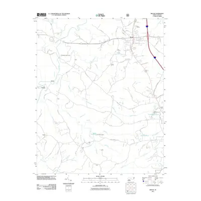
2011 Map of Biscoe
USGS Topo · Published 2011About this map
The settlement of Biscoe serves as the primary hub in this corner of Montgomery County, defined by a grid of residential streets like Green St and Church St situated near Lick Creek. To the west and south, the landscape is characterized by a dense network of watercourses, most notably the Little River and its various tributaries including Densons Creek and Cedar Creek. Historical industry and water management are evident at the Smitherman Millpond Dam and the Lewis Millpond Dam on Little Creek, which created the Lewis Mill Pond.
Find a feature on this map
121 named features on this map. Tap any name to fly to it.
Don’t see what you’re looking for? This feature index may not catch every label — zoom into the map to look around manually.
Map Details
Editions of this 2011 Biscoe Map
This is the sole edition of this map. No revisions or reprints were ever made.
Other maps of this area

1942 · Troy
USGS Topo · 1:125,000

1949 · Jackson Springs
USGS Topo · 1:62,500

1950 · Norman
USGS Topo · 1:24,000

1953 · Raleigh
USGS Topo · 1:250,000

1954 · Raleigh
USGS Topo · 1:250,000

1956 · Mount Gilead East
USGS Topo · 1:24,000

1956 · Harrisville
USGS Topo · 1:24,000

1957 · Troy
USGS Topo · 1:62,500
1957 · Jackson Springs
USGS Topo · 1:62,500

1974 · Candor
USGS Topo · 1:24,000