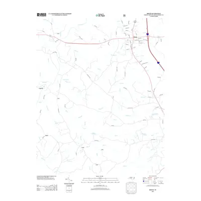
2013 Map of Biscoe
USGS Topo · Published 2013About this map
The town of Biscoe serves as the primary hub for this portion of Montgomery County, showing its modern street grid and connectivity near the intersection of major regional routes. The landscape transitions into rural timber and agricultural lands, marked by smaller settlements like Capelsie and Onvil. Water defines much of the local geography, with the Little River and a dense network of tributaries including Cedar Cr and Bridgers Cr draining the terrain. Several significant impoundments, such as Lewis Mill Pond, McCullums Pond, and Parson Brothers Pond, suggest a history of water management for local industry or agriculture. The map also records numerous family-named roads and landmarks, including Chicken Farm Rd and Gold Br, which point to the area's agricultural and resource-based heritage during the early 21st century.
Find a feature on this map
85 named features on this map. Tap any name to fly to it.
Don’t see what you’re looking for? This feature index may not catch every label — zoom into the map to look around manually.
Map Details
Editions of this 2013 Biscoe Map
This is the sole edition of this map. No revisions or reprints were ever made.
Other maps of this area

1942 · Troy
USGS Topo · 1:125,000

1949 · Jackson Springs
USGS Topo · 1:62,500

1950 · Norman
USGS Topo · 1:24,000

1953 · Raleigh
USGS Topo · 1:250,000

1954 · Raleigh
USGS Topo · 1:250,000

1956 · Mount Gilead East
USGS Topo · 1:24,000

1956 · Harrisville
USGS Topo · 1:24,000

1957 · Troy
USGS Topo · 1:62,500
1957 · Jackson Springs
USGS Topo · 1:62,500

1974 · Candor
USGS Topo · 1:24,000