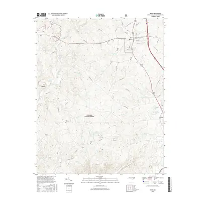
2016 Map of Biscoe
USGS Topo · Published 2016About this map
Uwharrie National Forest anchors the central and southern portions of this Montgomery County landscape, where the terrain is defined by a dense network of creek drainages including Big Cr, Bridgers Cr, and Thickety Cr. The settled corridor along the eastern edge is defined by the towns of Biscoe and Candor, showing the established residential patterns and local cemeteries like Biscoe Cem and Candor Cem that serve these communities. To the west, the edge of Troy and the settlement at Capelsie sit near the winding course of the Little River. This 2016 survey highlights a mix of public forest land and private industry, evidenced by features such as Smitherman Mill Pond and Lewis Mill Pond. The mapping of family-named landmarks like McCallums Pond and Lewis Cem provides valuable spatial context for researchers tracing the mid-20th-century development of the region's rural and town life.
Find a feature on this map
84 named features on this map. Tap any name to fly to it.
Don’t see what you’re looking for? This feature index may not catch every label — zoom into the map to look around manually.
Map Details
Editions of this 2016 Biscoe Map
This is the sole edition of this map. No revisions or reprints were ever made.
Other maps of this area

1942 · Troy
USGS Topo · 1:125,000

1949 · Jackson Springs
USGS Topo · 1:62,500

1950 · Norman
USGS Topo · 1:24,000

1953 · Raleigh
USGS Topo · 1:250,000

1954 · Raleigh
USGS Topo · 1:250,000

1956 · Mount Gilead East
USGS Topo · 1:24,000

1956 · Harrisville
USGS Topo · 1:24,000

1957 · Troy
USGS Topo · 1:62,500
1957 · Jackson Springs
USGS Topo · 1:62,500

1974 · Candor
USGS Topo · 1:24,000