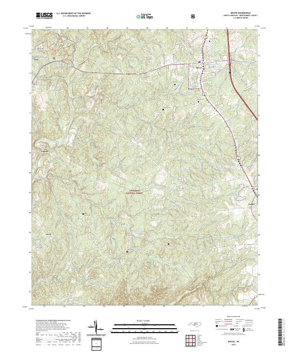
2022 Map of Biscoe
USGS Topo · Published 2022About this map
Uwharrie National Forest dominates the heart of this landscape, where the dense woodlands of central Montgomery County are carved by a network of creeks like Thickety Cr and Little Cr. The settlement patterns follow the higher ground, with Biscoe and Candor anchored by the Norfolk Southern rail line on the eastern edge, while Troy and Montgomery Community College define the northwest corner. This area is characterized by a significant number of family and community burial grounds, including the Piney Grove Cem and Lewis Cem, which reflect the deep-rooted rural genealogy of the region. Water management is evident in several small impoundments such as Lewis Mill Pond and Parson Brothers Pond, which historically supported local industry and agriculture amidst the winding course of the Little River.
Find a feature on this map
92 named features on this map. Tap any name to fly to it.
Don’t see what you’re looking for? This feature index may not catch every label — zoom into the map to look around manually.
Map Details
Editions of this 2022 Biscoe Map
This is the sole edition of this map. No revisions or reprints were ever made.
Other maps of this area

1942 · Troy
USGS Topo · 1:125,000

1949 · Jackson Springs
USGS Topo · 1:62,500

1950 · Norman
USGS Topo · 1:24,000

1953 · Raleigh
USGS Topo · 1:250,000

1954 · Raleigh
USGS Topo · 1:250,000

1956 · Mount Gilead East
USGS Topo · 1:24,000

1956 · Harrisville
USGS Topo · 1:24,000

1957 · Troy
USGS Topo · 1:62,500
1957 · Jackson Springs
USGS Topo · 1:62,500

1974 · Candor
USGS Topo · 1:24,000