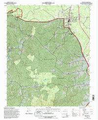
1994 Map of Biscoe
USGS Topo · Published 1996About this map
Uwharrie National Forest dominates the southwestern landscape of this map, where the winding course of the Little River meets numerous tributaries like Cedar Creek and Big Creek. The industrial and educational character of the region is evident in the northern settlements, with the presence of a Foundry in Biscoe and the Montgomery Tech Institute near Beaman. The Norfolk Southern railroad tracks run vertically through Biscoe and Candor, serving as a vital transport corridor for the community and local commerce. Rural life is anchored by a dense network of small congregations and burial grounds, including Macedonia Ch, Hickory Grove Ch, and Gilis Cem. Notable local landmarks range from the cultural, such as the Drive-in Theater near Kellam, to the functional Filtration Plant and Radio Tower (WMTN), illustrating the development of this Montgomery County area in the mid-1990s.
Find a feature on this map
54 named features on this map. Tap any name to fly to it.
Don’t see what you’re looking for? This feature index may not catch every label — zoom into the map to look around manually.
Map Details
Editions of this 1994 Biscoe Map
This is the sole edition of this map. No revisions or reprints were ever made.
Other maps of this area

1942 · Troy
USGS Topo · 1:125,000

1949 · Jackson Springs
USGS Topo · 1:62,500

1950 · Norman
USGS Topo · 1:24,000

1953 · Raleigh
USGS Topo · 1:250,000

1954 · Raleigh
USGS Topo · 1:250,000

1956 · Mount Gilead East
USGS Topo · 1:24,000

1956 · Harrisville
USGS Topo · 1:24,000

1957 · Troy
USGS Topo · 1:62,500
1957 · Jackson Springs
USGS Topo · 1:62,500

1974 · Candor
USGS Topo · 1:24,000