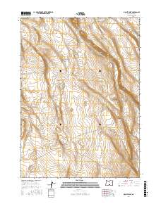
2017 Map of Biscuit Point
USGS Topo · Published 2017About this map
Biscuit Point and the surrounding high desert of Lake County are defined by a landscape of intermittent water sources and dramatic elevation changes. This 2017 topographic study highlights the critical importance of water management in this arid region, featuring specifically named infrastructure such as Brattain Waterhole Number 5 and Keen Waterhole. The terrain is marked by distinctive formations like Twin Buttes and the descent into Sand Canyon, illustrating the natural drainage patterns that shape this part of Oregon.
Find a feature on this map
12 named features on this map. Tap any name to fly to it.
Don’t see what you’re looking for? This feature index may not catch every label — zoom into the map to look around manually.
Map Details
Editions of this 2017 Biscuit Point Map
This is the sole edition of this map. No revisions or reprints were ever made.
Other maps of this area
1955 · Klamath Falls
USGS Topo · 1:250,000
1958 · Klamath Falls
USGS Topo · 1:250,000
1966 · Coglan Buttes NE
USGS Topo · 1:24,000
1966 · Coglan Buttes
USGS Topo · 1:24,000
1968 · Lake Abert North
USGS Topo · 1:24,000
1974 · Lake Abert
USGS Topo · 1:100,000
1984 · Sawed Horn
USGS Topo · 1:24,000
1984 · Poverty Basin South
USGS Topo · 1:24,000
1985 · Sharp Top
USGS Topo · 1:24,000
1985 · Biscuit Point
USGS Topo · 1:24,000