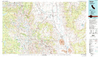
1978 Map of Bishop
USGS Topo · Published 1994About this map
The Owens Valley corridor anchors this 1970s survey, serving as the high-desert transition between the massive peaks of the Sierra National Forest and the White Mountains. The town of Bishop stands as the regional hub, surrounded by smaller settlements like Scheelite, Rovana, and Oteys Sierra Village. The landscape is defined by extensive water management and mineral extraction, evidenced by the Owens River flowing south toward the Tinemaha Reservoir and the presence of numerous specialized mining operations. Notable sites include the Pine Creek Mine and Tungstar Mine in the Tungsten Hills, reflecting the area's industrial legacy. To the east, the Ancient Bristlecone Pine Forest and the Deep Springs Valley offer a stark contrast to the glaciated high country of the John Muir Wilderness, where major summits like Mt Tom and Mt Humphreys overlook Humphreys Basin.
Find a feature on this map
113 named features on this map. Tap any name to fly to it.
Don’t see what you’re looking for? This feature index may not catch every label — zoom into the map to look around manually.
Map Details
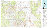
Editions of this 1978 Bishop Map
2 editions found
Other maps of this area

1898 · Silver Peak
USGS Topo · 1:125,000

1900 · Silver Peak
USGS Topo · 1:125,000

1901 · Mt. Lyell
USGS Topo · 1:125,000

1903 · Tehipite
USGS Topo · 1:125,000

1904 · Kaiser
USGS Topo · 1:125,000

1905 · Tehipite
USGS Topo · 1:125,000

1907 · Mt. Whitney
USGS Topo · 1:125,000

1908 · Lida
USGS Topo · 1:250,000

1908 · Ballarat
USGS Topo · 1:250,000

1912 · Mt. Goddard
USGS Topo · 1:125,000