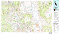
1978 Map of Bishop
USGS Topo · Published 1994About this map
The Owens River carves through this late-1970s landscape, flanked by the steep walls of the Owens River Gorge and the sprawling Volcanic Tableland. Industrial activity is deeply etched into the terrain, particularly around the Tungsten Hills where the Pine Creek Mine and Tungsten Mine highlight a legacy of mineral extraction near the company-driven settlements of Scheelite and Rovana. The valley floor is a complex network of water management, evidenced by the McNally Canal and Bishop Canal, which divert water through the agricultural heart of Bishop.
Find a feature on this map
111 named features on this map. Tap any name to fly to it.
Don’t see what you’re looking for? This feature index may not catch every label — zoom into the map to look around manually.
Map Details
Editions of this 1978 Bishop Map
2 editions found
Other maps of this area

1898 · Silver Peak
USGS Topo · 1:125,000

1900 · Silver Peak
USGS Topo · 1:125,000

1901 · Mt. Lyell
USGS Topo · 1:125,000

1903 · Tehipite
USGS Topo · 1:125,000

1904 · Kaiser
USGS Topo · 1:125,000

1905 · Tehipite
USGS Topo · 1:125,000

1907 · Mt. Whitney
USGS Topo · 1:125,000

1908 · Lida
USGS Topo · 1:250,000

1908 · Ballarat
USGS Topo · 1:250,000

1912 · Mt. Goddard
USGS Topo · 1:125,000