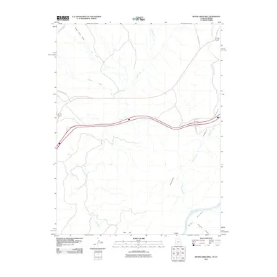
2011 Map of Bitter Creek Well
USGS Topo · Published 2011About this map
Bitter Creek Well and the small settlement of Utaline anchor this arid landscape along the Utah-Colorado border. The terrain is defined by a network of seasonal drainages, including Winter Camp Draw, San Arroyo Wash, and Bryson Wash, all feeding into the meandering course of Bitter Creek. In the southeast, the geography drops toward the Colorado River at Ruby Canyon, where the river carves through the earth near Knowles Canyon. Transport and recreation are central to the area's modern identity, with the Kokopelli Trl winding through Rabbit Valley. Significant elevation changes are noted at Castle Rocks and across the high expanse of May Flat, illustrating the transition from open flats to deep canyon systems that characterize this borderland region.
Find a feature on this map
21 named features on this map. Tap any name to fly to it.
Don’t see what you’re looking for? This feature index may not catch every label — zoom into the map to look around manually.
Map Details
Editions of this 2011 Bitter Creek Well Map
This is the sole edition of this map. No revisions or reprints were ever made.
Other maps of this area

1885 · East Tavaputs
USGS Topo · 1:250,000

1954 · Westwater 4 SW
USGS Topo · 1:24,000

1956 · Westwater 4 SE
USGS Topo · 1:24,000

1956 · Grand Junction
USGS Topo · 1:250,000

1959 · Grand Junction
USGS Topo · 1:250,000

1960 · Grand Junction
USGS Topo · 1:250,000

1962 · Grand Junction
USGS Topo · 1:250,000

1964 · Grand Junction
USGS Topo · 1:250,000

1965 · Grand Junction
USGS Topo · 1:250,000

1968 · Badger Wash
USGS Topo · 1:24,000