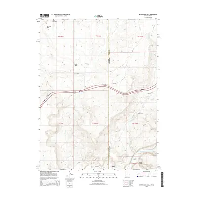
2014 Map of Bitter Creek Well
USGS Topo · Published 2014About this map
The Utah-Colorado border slices through this high desert terrain, where the interstate corridor follows the natural passage of Rabbit Valley. In the southeastern corner, the Colorado River carves through the dramatic Ruby Canyon and Knowles Canyon, creating a landscape of deep relief and geological significance. Local infrastructure is sparse, defined by the isolated settlement of Utaline and the presence of the Bitter Creek Well, indicating the importance of water management in this arid environment. The map details a network of rural routes such as Crow Ridge Rd and M 8/10 RD that navigate the ridges and washes. Landmarks like Castle Rocks and Harleys Dome serve as prominent navigation points across the broken ground of San Arroyo Wash and Bryson Wash.
Find a feature on this map
28 named features on this map. Tap any name to fly to it.
Don’t see what you’re looking for? This feature index may not catch every label — zoom into the map to look around manually.
Map Details
Editions of this 2014 Bitter Creek Well Map
This is the sole edition of this map. No revisions or reprints were ever made.
Other maps of this area

1885 · East Tavaputs
USGS Topo · 1:250,000

1954 · Westwater 4 SW
USGS Topo · 1:24,000

1956 · Westwater 4 SE
USGS Topo · 1:24,000

1956 · Grand Junction
USGS Topo · 1:250,000

1959 · Grand Junction
USGS Topo · 1:250,000

1960 · Grand Junction
USGS Topo · 1:250,000

1962 · Grand Junction
USGS Topo · 1:250,000

1964 · Grand Junction
USGS Topo · 1:250,000

1965 · Grand Junction
USGS Topo · 1:250,000

1968 · Badger Wash
USGS Topo · 1:24,000