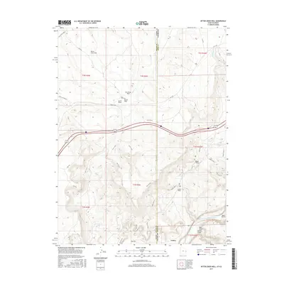
2017 Map of Bitter Creek Well
USGS Topo · Published 2017About this map
Utaline sits at the high-desert borderlands between Utah and Colorado, where the Colorado River carves through the southern reaches of this landscape near Ruby Canyon. The terrain is defined by complex drainage systems and escarpments, including the Zion Curtain and the Western Rim, which separate high flats like May Flat from the deeper canyon floors. In the northern portion of the map, the Bitter Creek Well serves as a lone named waypoint in a region of dry washes such as San Arroyo Wash and Bryson Wash. This 2017 survey reveals the intersection of early ranching and resource-extraction geography with modern infrastructure, as the Interstate corridors navigate the natural obstacles formed by Castle Rocks and Knowles Canyon. The map records a sparsely populated but geographically distinct frontier, where the Stateline road and the Mac Intyre Cutoff trace paths through the high Grand Valley.
Find a feature on this map
38 named features on this map. Tap any name to fly to it.
Don’t see what you’re looking for? This feature index may not catch every label — zoom into the map to look around manually.
Map Details
Editions of this 2017 Bitter Creek Well Map
This is the sole edition of this map. No revisions or reprints were ever made.
Other maps of this area

1885 · East Tavaputs
USGS Topo · 1:250,000

1954 · Westwater 4 SW
USGS Topo · 1:24,000

1956 · Westwater 4 SE
USGS Topo · 1:24,000

1956 · Grand Junction
USGS Topo · 1:250,000

1959 · Grand Junction
USGS Topo · 1:250,000

1960 · Grand Junction
USGS Topo · 1:250,000

1962 · Grand Junction
USGS Topo · 1:250,000

1964 · Grand Junction
USGS Topo · 1:250,000

1965 · Grand Junction
USGS Topo · 1:250,000

1968 · Badger Wash
USGS Topo · 1:24,000