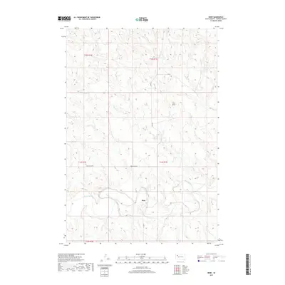
2017 Map of Bixby
USGS Topo · Published 2017About this map
The settlement of Bixby sits along the southern banks of the Moreau River, serving as a focal point for this expansive section of Perkins County. This survey reveals a landscape shaped by intermittent watercourses like Cabin Cr, which meanders through the northern sections before joining the river valley. The topography is defined by significant elevations such as Stony Butte, providing distinct visual landmarks across the township lines of t15n r13e and t14n r13e. A network of rural routes, including Bixby Rd and Moreau River Rd, tracks the natural contours of the river basin, illustrating the enduring transport patterns of the West River region. The arrangement of section lines and isolated roads like Kari Rd underscores the sparse, ranch-oriented settlement typical of the high plains during the early twenty-first century.
Find a feature on this map
12 named features on this map. Tap any name to fly to it.
Don’t see what you’re looking for? This feature index may not catch every label — zoom into the map to look around manually.
Map Details
Editions of this 2017 Bixby Map
This is the sole edition of this map. No revisions or reprints were ever made.
Other maps of this area

1951 · Cedar Canyon
USGS Topo · 1:24,000

1951 · Maurine
USGS Topo · 1:24,000

1951 · Imogene
USGS Topo · 1:24,000

1951 · Deep Creek NW
USGS Topo · 1:24,000

1951 · Bixby
USGS Topo · 1:24,000

1952 · Signal Butte
USGS Topo · 1:24,000

1954 · Lemmon
USGS Topo · 1:250,000

1957 · Lemmon
USGS Topo · 1:250,000

1983 · Rabbit Butte
USGS Topo · 1:24,000

1983 · Date
USGS Topo · 1:24,000