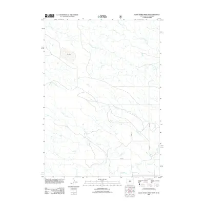
2012 Map of Black Banks Creek West
USGS Topo · Published 2012About this map
Hydrological patterns across the High Plains of Dawes County define this 2012 survey, where the ephemeral nature of the landscape is represented by Dry Lake in the northwestern quadrant. The drainage network is dense, dominated by the systems of Duck Cr and Medicine Cr which carve through the terrain. Evidence of the region's ranching infrastructure is visible in the localized road network, including Co HWY 5 and its various spurs like Co HWY 5g and Co HWY 5c, providing access to the remote draws and creek beds. To the north, the diverging branches of N Black Banks Cr and S Black Banks Cr illustrate the complex watershed boundaries typical of this corner of Nebraska. Other prominent watercourses include Collingwood Cr, Horsehead Cr, and Long Hollow Cr, which dictate the movement of both water and livestock through the plains.
Find a feature on this map
11 named features on this map. Tap any name to fly to it.
Don’t see what you’re looking for? This feature index may not catch every label — zoom into the map to look around manually.
Map Details
Editions of this 2012 Black Banks Creek West Map
This is the sole edition of this map. No revisions or reprints were ever made.
Other maps of this area

1896 · Oelrichs
USGS Topo · 1:125,000

1900 · Oelrichs
USGS Topo · 1:125,000

1902 · Edgemont
USGS Topo · 1:125,000

1950 · Heppner
USGS Topo · 1:24,000

1955 · Hot Springs
USGS Topo · 1:250,000

1955 · Alliance
USGS Topo · 1:250,000

1957 · Alliance
USGS Topo · 1:250,000

1958 · Alliance
USGS Topo · 1:250,000

1980 · Wolf Butte
USGS Topo · 1:24,000

1980 · Lone Tree Ranch
USGS Topo · 1:24,000