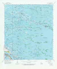
1964 Map of Black Bay
USGS Topo · Published 1965About this map
Pointe a la Hache and the settlements along the Mississippi River corridor anchor the southwestern edge of this amphibious landscape. This mid-1960s revision by the Mississippi River Commission details a complex web of marshes and lagoons where land and water are inextricably linked. The map records the industrial footprint of the era, marked by the extensive Black Bay Oil and Gas Field and the North Black Bay Oil Field, which punctuate the open waters of Black Bay. To the west, the riverbank is dotted with local landmarks like Our Lady of Lourdes Ch and the Bohemia Cem, serving the small communities of Happy Jack and Encalade. Beyond the levee, the map dissolves into a labyrinth of named passes and bays, such as Dead Duck Pass and Bay Gardene, illustrating the dynamic nature of the Plaquemines Parish coastline before decades of coastal erosion further altered these marshy boundaries.
Find a feature on this map
68 named features on this map. Tap any name to fly to it.
Don’t see what you’re looking for? This feature index may not catch every label — zoom into the map to look around manually.
Map Details
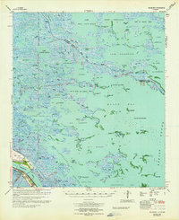
Editions of this 1964 Black Bay Map
2 editions found
Other maps of this area

1891 · Pointe a La Hache
USGS Topo · 1:62,500

1892 · Quarantine
USGS Topo · 1:62,500

1892 · St. Bernard
USGS Topo · 1:62,500

1892 · Pointe a La Hache
USGS Topo · 1:62,500

1893 · La Fortuna
USGS Topo · 1:62,500

1893 · Forts
USGS Topo · 1:62,500

1893 · Shell Beach
USGS Topo · 1:62,500

1893 · Fort Livingston
USGS Topo · 1:62,500

1893 · Dime
USGS Topo · 1:62,500

1895 · Bodreau
USGS Topo · 1:62,500