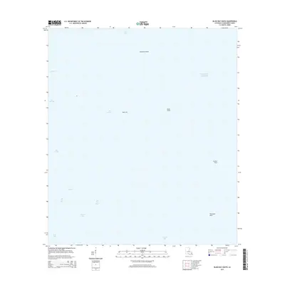
2015 Map of Black Bay South
USGS Topo · Published 2015About this map
Belle Isle and Lonesome Island anchor this coastal Louisiana landscape where the waters of the Gulf Of Mexico meet a complex network of bays and passes. In this portion of Plaquemines Parish, the land-to-water ratio illustrates a disappearing marshland, defined by prominent points like Curfew Point and Telegraph Point. The map details the intricate hydrography of the region, ranging from the open waters of Black Bay and California Bay to smaller, isolated features such as Bayou Lost and Whiskey Bay. Navigational markers like Bel Pass and Bel La Pass indicate the natural channels through which water moves through Bay Crabe and Bay Gardene. The absence of roads or terrestrial infrastructure underscores the environment’s character, where Stone Island stands as one of the few named landforms in an otherwise fluid coastal landscape.
Find a feature on this map
17 named features on this map. Tap any name to fly to it.
Don’t see what you’re looking for? This feature index may not catch every label — zoom into the map to look around manually.
Map Details
Editions of this 2015 Black Bay South Map
This is the sole edition of this map. No revisions or reprints were ever made.
Other maps of this area

1892 · Quarantine
USGS Topo · 1:62,500

1893 · La Fortuna
USGS Topo · 1:62,500

1893 · Forts
USGS Topo · 1:62,500

1893 · Dime
USGS Topo · 1:62,500

1935 · Port Sulphur
USGS Topo · 1:31,680

1935 · Lake Athanasio
USGS Topo · 1:31,680

1935 · Lake Calebasse
USGS Topo · 1:31,680

1935 · Tropical Bend
USGS Topo · 1:31,680

1941 · Black Bay
USGS Topo · 1:62,500

1941 · Empire
USGS Topo · 1:62,500