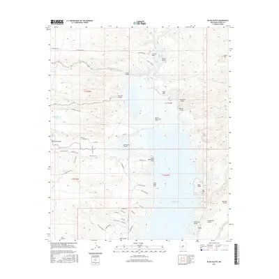
2017 Map of Black Bluffs
USGS Topo · Published 2017About this map
Elephant Butte Reservoir dominates this high-desert landscape in Sierra County, where the Rio Grande flows south through the constricted passage of The Narrows. The terrain is defined by dramatic elevation changes, notably at the namesake Black Bluffs and Red Cliff on the eastern shore. The map illustrates a transition from the wilder northern reaches of the reservoir toward developing recreation areas and residential roads in the south, such as Cedar Canyon Blvd and Lakeview Park Dr. Numerous dry washes and drainage systems, including Monticello Canyon and Alamosa Creek, cut through the surrounding tablelands. Local landmarks like Mitchell Point and the White Cliffs provide navigational markers along the water, while the presence of Blander Reservoir Number One to the west suggests early ranching or water management efforts on the higher flats away from the main river valley.
Find a feature on this map
58 named features on this map. Tap any name to fly to it.
Don’t see what you’re looking for? This feature index may not catch every label — zoom into the map to look around manually.
Map Details
Editions of this 2017 Black Bluffs Map
This is the sole edition of this map. No revisions or reprints were ever made.
Other maps of this area

1954 · Tularosa
USGS Topo · 1:250,000

1958 · Tularosa
USGS Topo · 1:250,000

1958 · Elephant Butte
USGS Topo · 1:24,000

1959 · Engle
USGS Topo · 1:62,500

1961 · Huerfano Hill
USGS Topo · 1:24,000

1961 · Sierra Fijardo
USGS Topo · 1:24,000

1961 · Black Bluffs
USGS Topo · 1:24,000

1961 · Crocker
USGS Topo · 1:24,000

1961 · Lava
USGS Topo · 1:24,000

1961 · Cuchillo
USGS Topo · 1:24,000