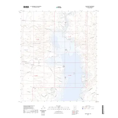
2023 Map of Black Bluffs
USGS Topo · Published 2023About this map
Elephant Butte Reservoir dominates this high-desert landscape, where the Rio Grande carves a path through distinctive geological formations. The northern reach of the reservoir is defined by The Narrows, a constriction flanked by Mitchell Point and the striking White Cliffs. This modern survey reveals a network of roads and trails, such as Monticello Point Rd and Lakeshore Rd, that navigate the jagged shoreline and deep drainages like Hellion Canyon and Pinosa Canyon.
Find a feature on this map
56 named features on this map. Tap any name to fly to it.
Don’t see what you’re looking for? This feature index may not catch every label — zoom into the map to look around manually.
Map Details
Editions of this 2023 Black Bluffs Map
This is the sole edition of this map. No revisions or reprints were ever made.
Other maps of this area

1954 · Tularosa
USGS Topo · 1:250,000

1958 · Tularosa
USGS Topo · 1:250,000

1958 · Elephant Butte
USGS Topo · 1:24,000

1959 · Engle
USGS Topo · 1:62,500

1961 · Huerfano Hill
USGS Topo · 1:24,000

1961 · Sierra Fijardo
USGS Topo · 1:24,000

1961 · Black Bluffs
USGS Topo · 1:24,000

1961 · Crocker
USGS Topo · 1:24,000

1961 · Lava
USGS Topo · 1:24,000

1961 · Cuchillo
USGS Topo · 1:24,000