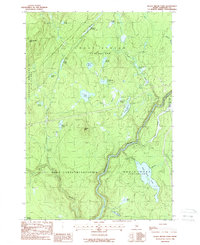
1988 Map of Black Brook Pond
USGS Topo · Published 1988About this map
The Kennebec River carves a deep valley through this Maine township, defining the landscape of West Forks Plantation and the surrounding unorganized territories in the late 1980s. This survey illustrates the intricate water network of Somerset County, where significant drainages like Black Brook and Chase Stream feed into the river system. The map highlights the complex Maine land system of townships and ranges, clearly delineating boundaries for Moxie Gore, Squaretown, and Johnson Mountain. Numerous ponds such as Ellis Pond and Black Brook Pond are scattered throughout the timberlands, connected by primitive logging routes like the Tracy Line. An active Gravel Pit and various private roads suggest the industrial use of the land for forestry and resource extraction during this era.
Find a feature on this map
33 named features on this map. Tap any name to fly to it.
Don’t see what you’re looking for? This feature index may not catch every label — zoom into the map to look around manually.
Map Details
Editions of this 1988 Black Brook Pond Map
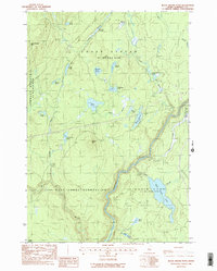
2 editions found
Other maps of this area

1905 · The Forks
USGS Topo · 1:62,500

1907 · The Forks
USGS Topo · 1:62,500

1921 · Brassua Lake
USGS Topo · 1:62,500

1922 · Long Pond
USGS Topo · 1:62,500

1923 · Brassua Lake
USGS Topo · 1:62,500

1924 · Long Pond
USGS Topo · 1:62,500

1925 · Pierce Pond
USGS Topo · 1:48,000

1927 · Pierce Pond
USGS Topo · 1:62,500

1944 · Brassua Lake
USGS Topo · 1:62,500

1944 · Long Pond
USGS Topo · 1:62,500
Featured Places
- West Forks, ME
- Squaretown Township, ME
- Johnson Mountain Township, ME
- Chase Stream Township, ME
- Moxie Gore, ME