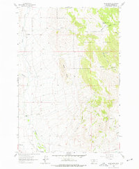
1963 Map of Black Butte
USGS Topo · Published 1977About this map
The rugged topography of Black Butte and St Paul Gulch dominates this 1963 survey of Jefferson County. Located along the western edge of the Deerlodge National Forest, the landscape is defined by ranching and mining activities concentrated near the drainages of Whitetail Creek and Fitz Creek. Local ranching history is evidenced by the Forcella Ranch and Whitehall Ranch, while the older settlement patterns of the area can be traced at the Old Whitehall Cem. Prospectors and miners once combed the slopes of the forest, leaving behind numerous Mines and Prospects that punctuate the higher elevations near Sunlight. The water resources of the high country, including Tobay Spring and South Cottonwood Spring, appear essential for supporting these remote operations and livestock in the arid Montana foothills.
Find a feature on this map
29 named features on this map. Tap any name to fly to it.
Don’t see what you’re looking for? This feature index may not catch every label — zoom into the map to look around manually.
Map Details
Editions of this 1963 Black Butte Map
3 editions found
Other maps of this area

1886 · Fort Logan
USGS Topo · 1:250,000

1888 · Three Forks
USGS Topo · 1:250,000

1889 · Helena
USGS Topo · 1:250,000

1893 · Helena
USGS Topo · 1:250,000

1893 · Dillon
USGS Topo · 1:250,000

1894 · Three Forks
USGS Topo · 1:250,000

1895 · Three Forks
USGS Topo · 1:250,000

1899 · Boulder
USGS Topo · 1:125,000

1899 · Helena
USGS Topo · 1:250,000

1903 · Helena
USGS Topo · 1:250,000