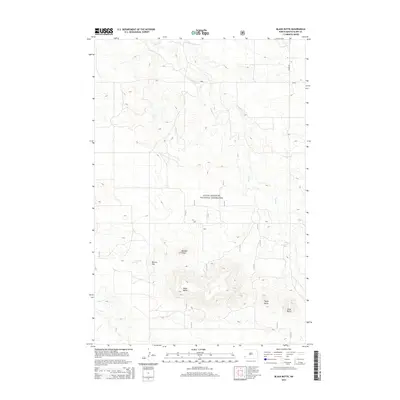
2014 Map of Black Butte
USGS Topo · Published 2014About this map
Little Missouri National Grassland encompasses this high plains landscape in Slope County, where the terrain is defined by dramatic elevations and isolated peaks. The most prominent of these is Black Butte, standing as a significant landmark in the southwestern portion of the sheet alongside Tepee Butte and Slide Butte. The drainage patterns of the area are established by the winding course of Sand Cr which traverses the northern and eastern sections, while Deep Cr touches the southwestern corner. This area of North Dakota remains largely open and undeveloped, with travel dictated by the path of Co RD and E River Rd. Local landmarks such as Boulder Point and Browns Hill provide further orientation within this part of the Badlands, reflecting a landscape where geological features often serve as the primary markers for navigation and land use.
Find a feature on this map
10 named features on this map. Tap any name to fly to it.
Don’t see what you’re looking for? This feature index may not catch every label — zoom into the map to look around manually.
Map Details
Editions of this 2014 Black Butte Map
This is the sole edition of this map. No revisions or reprints were ever made.
Other maps of this area

1953 · Dickinson
USGS Topo · 1:250,000

1957 · Dickinson
USGS Topo · 1:250,000

1961 · Rocky Ridge
USGS Topo · 1:62,500

1973 · Black Butte
USGS Topo · 1:24,000

1973 · Amidon SE
USGS Topo · 1:24,000

1973 · Stewart Lake
USGS Topo · 1:24,000

1973 · Amidon
USGS Topo · 1:24,000

1979 · Deep Creek North
USGS Topo · 1:24,000

1980 · Belfield
USGS Topo · 1:100,000

1981 · Bowman
USGS Topo · 1:100,000