
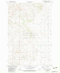
1973 Map of Black Butte
USGS Topo · Published 1976About this map
Chalky Butte dominates the central portion of this southwestern North Dakota landscape, rising above the drainage systems of West Sand Creek and East Sand Creek. Surveyed in the early 1970s, the terrain is defined by prominent elevations like Boulder Point and Browns Hill which overlook the winding tributaries of Deep Creek. The map documents a sparsely populated ranching environment where section lines are occasionally traced by a Jeep Trail, leading toward significant topographic landmarks such as Black Butte, Tepee Butte, and Slide Butte. This area of Slope County showcases the intricate erosion patterns and scattered Gravel Pit sites typical of the regional geography before modern large-scale development shifted the rural character.
Find a feature on this map
14 named features on this map. Tap any name to fly to it.
Don’t see what you’re looking for? This feature index may not catch every label — zoom into the map to look around manually.
Map Details
Editions of this 1973 Black Butte Map
This is the sole edition of this map. No revisions or reprints were ever made.
Other maps of this area

1953 · Dickinson
USGS Topo · 1:250,000

1957 · Dickinson
USGS Topo · 1:250,000

1961 · Rocky Ridge
USGS Topo · 1:62,500

1973 · Amidon SE
USGS Topo · 1:24,000

1973 · Stewart Lake
USGS Topo · 1:24,000

1973 · Amidon
USGS Topo · 1:24,000

1979 · Deep Creek North
USGS Topo · 1:24,000

1980 · Belfield
USGS Topo · 1:100,000

1981 · Bowman
USGS Topo · 1:100,000
1982 · Rocky Ridge South
USGS Topo · 1:24,000