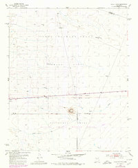
1952 Map of Black Butte
USGS Topo · Published 1980About this map
Black Butte Vabm 5478 Turututu serves as a prominent landmark at the convergence of several historic land grants in central New Mexico. This landscape is defined by the intersections of the Belen Grant, Casa Colorada Grant, and Sevilleta Grant, illustrating the enduring legacy of Spanish and Mexican land divisions. The southern portion of the map transitions into the Sevilleta National Wildlife Refuge, where the terrain is marked by seasonal watercourses like Pino Draw, Arroyo Abo, and Maes Arroyo.
Find a feature on this map
17 named features on this map. Tap any name to fly to it.
Don’t see what you’re looking for? This feature index may not catch every label — zoom into the map to look around manually.
Map Details
Editions of this 1952 Black Butte Map
2 editions found
Other maps of this area

1916 · La Joya
USGS Topo · 1:125,000

1952 · Tome SE
USGS Topo · 1:24,000

1952 · Black Butte
USGS Topo · 1:24,000

1952 · La Joya
USGS Topo · 1:24,000

1952 · Turn
USGS Topo · 1:24,000

1952 · Veguita
USGS Topo · 1:24,000

1952 · Becker SW
USGS Topo · 1:24,000

1952 · Becker
USGS Topo · 1:24,000

1952 · Abeytas
USGS Topo · 1:24,000

1952 · Cerro Montoso
USGS Topo · 1:24,000