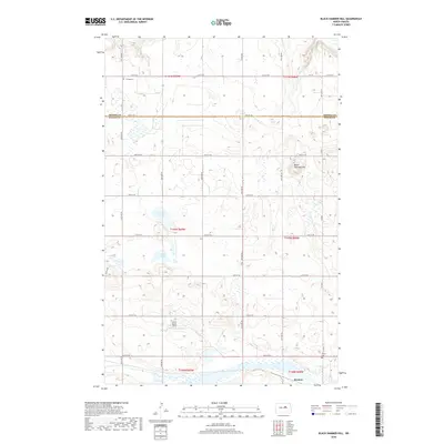
2018 Map of Black Hammer Hill
USGS Topo · Published 2018About this map
The boundary between Benson and Wells Counties bisects this section of the North Dakota prairie, characterized by a complex network of small wetlands and glacial lakes. The southern portion of the map is anchored by the small settlement of Bremen, situated near the Trinity Cemetery. The landscape is defined by the high point of Black Hammer Hill and numerous water bodies, including Norway Lake, Goose Lake, and Zump Lake.
Find a feature on this map
31 named features on this map. Tap any name to fly to it.
Don’t see what you’re looking for? This feature index may not catch every label — zoom into the map to look around manually.
Map Details
Editions of this 2018 Black Hammer Hill Map
This is the sole edition of this map. No revisions or reprints were ever made.
Other maps of this area

1932 · Flora
USGS Topo · 1:62,500

1943 · Maddock
USGS Topo · 1:62,500

1945 · Maddock
USGS Topo · 1:62,500

1948 · Cathay
USGS Topo · 1:62,500

1948 · Fessenden
USGS Topo · 1:62,500

1948 · Bremen
USGS Topo · 1:24,000

1949 · Bremen
USGS Topo · 1:24,000

1949 · Fessenden East
USGS Topo · 1:24,000

1949 · Munster
USGS Topo · 1:24,000

1951 · Flora SE
USGS Topo · 1:24,000