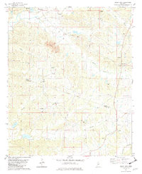
1982 Map of Black Hawk
USGS Topo · Published 1982About this map
Abiaca Creek and its southern tributaries wind through the dissected uplands of the Carroll and Holmes County line, defining a landscape of rural congregations and family burial grounds in the early 1980s. The settlement of Black Hawk sits at a central crossroads, supported by nearby institutions like Mt Pleasant Ch and Mt Pera Ch. Further south, the community of Acona marks the lower reaches of the quadrangle near Chicopa Creek.
Find a feature on this map
33 named features on this map. Tap any name to fly to it.
Don’t see what you’re looking for? This feature index may not catch every label — zoom into the map to look around manually.
Map Details
Editions of this 1982 Black Hawk Map
This is the sole edition of this map. No revisions or reprints were ever made.
Other maps of this area

1940 · Seven Pines
USGS Topo · 1:62,500

1940 · Lexington
USGS Topo · 1:62,500

1953 · Greenwood
USGS Topo · 1:250,000

1953 · West Point
USGS Topo · 1:250,000

1956 · Greenwood
USGS Topo · 1:250,000

1957 · Lexington
USGS Topo · 1:62,500

1957 · Seven Pines
USGS Topo · 1:62,500

1958 · West Point
USGS Topo · 1:250,000

1958 · Seven Pines
USGS Topo · 1:62,500

1958 · Lexington
USGS Topo · 1:62,500