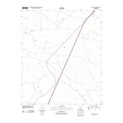
2010 Map of Black Hill
USGS Topo · Published 2010About this map
W Coupland Ranch and G Coupland Ranch anchor this Socorro County landscape, reflecting the sparse ranching patterns of the high desert. The terrain is defined by a series of significant drainage systems, including the long reaches of Nogal Canyon and Silver Canyon, which cut through the arid flats towards the Rio Grande valley to the east. The dominance of artificial water catchments like Wallace Tank, Coupland Tank, and the CCC Tank highlights the critical importance of water management for livestock in this environment. Centrally located, Black Hill rises as a distinct landmark alongside the modern corridor of Interstate 25, which parallels the older path of Highway 85. This 2010 survey illustrates how contemporary transportation infrastructure overlays a land still primarily organized around family ranching and traditional geographic markers like Bottle Hill and Crawford Hollow.
Find a feature on this map
17 named features on this map. Tap any name to fly to it.
Don’t see what you’re looking for? This feature index may not catch every label — zoom into the map to look around manually.
Map Details
Editions of this 2010 Black Hill Map
This is the sole edition of this map. No revisions or reprints were ever made.
Other maps of this area

1954 · Tularosa
USGS Topo · 1:250,000

1958 · Tularosa
USGS Topo · 1:250,000

1961 · Sierra Fijardo
USGS Topo · 1:24,000

1961 · Hickman Ranch
USGS Topo · 1:24,000

1961 · Paraje Well
USGS Topo · 1:24,000

1961 · Black Hill
USGS Topo · 1:24,000

1961 · Fort Craig
USGS Topo · 1:24,000

1961 · Lava
USGS Topo · 1:24,000

1961 · Romero Canyon
USGS Topo · 1:24,000

1964 · San Juan Peak
USGS Topo · 1:24,000