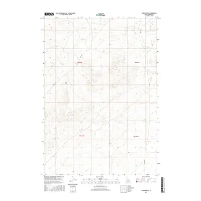
2017 Map of Black Knoll
USGS Topo · Published 2017About this map
Black Knoll rises as a prominent landmark in this section of Idaho, where the desert landscape is defined by vast volcanic and sedimentary features. In this 2017 study, the area is characterized by its sparse human infrastructure, with only fundamental routes like Sand Dune Rd and Sand Creek Rd providing access through the terrain. The map emphasizes the isolation of the Fremont County high desert, tracing the contours of a land where geologic forms take precedence over built environments. This topographic record highlights the intersection of public land survey sections and the natural topography, serving as a clean reference for the relief of the regional volcanic plains.
Find a feature on this map
7 named features on this map. Tap any name to fly to it.
Don’t see what you’re looking for? This feature index may not catch every label — zoom into the map to look around manually.
Map Details
Editions of this 2017 Black Knoll Map
This is the sole edition of this map. No revisions or reprints were ever made.
Other maps of this area

1948 · Parker
USGS Topo · 1:24,000

1949 · Newdale
USGS Topo · 1:24,000

1950 · Parker
USGS Topo · 1:24,000

1950 · Newdale
USGS Topo · 1:24,000

1950 · St Anthony
USGS Topo · 1:24,000

1955 · Ashton
USGS Topo · 1:250,000

1955 · Driggs
USGS Topo · 1:250,000

1958 · Driggs
USGS Topo · 1:250,000

1958 · Ashton
USGS Topo · 1:250,000

1960 · Ashton
USGS Topo · 1:250,000