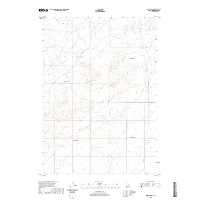
2020 Map of Black Knoll
USGS Topo · Published 2020About this map
Black Knoll anchors this high-desert landscape in Fremont County, where the topography is defined by intricate dune systems and volcanic rises. This modern survey reflects a region primarily managed through a network of unpaved routes, specifically Sand Dune Rd and Sand Creek Rd, which provide access through the undulating terrain. The map is heavily partitioned by the Public Land Survey System grid, shown through sections of t9n r40e, t9n r41e, t8n r40e, and t8n r41e. The absence of developed settlements or permanent structures emphasizes the area's role as a vast rangeland or protected desert environment, where the contour lines reveal a complex texture of sandy ridges and depressions typical of the eastern Snake River Plain.
Find a feature on this map
7 named features on this map. Tap any name to fly to it.
Don’t see what you’re looking for? This feature index may not catch every label — zoom into the map to look around manually.
Map Details
Editions of this 2020 Black Knoll Map
This is the sole edition of this map. No revisions or reprints were ever made.
Other maps of this area

1948 · Parker
USGS Topo · 1:24,000

1949 · Newdale
USGS Topo · 1:24,000

1950 · Parker
USGS Topo · 1:24,000

1950 · Newdale
USGS Topo · 1:24,000

1950 · St Anthony
USGS Topo · 1:24,000

1955 · Ashton
USGS Topo · 1:250,000

1955 · Driggs
USGS Topo · 1:250,000

1958 · Driggs
USGS Topo · 1:250,000

1958 · Ashton
USGS Topo · 1:250,000

1960 · Ashton
USGS Topo · 1:250,000