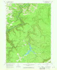
1959 Map of Black Moshannon
USGS Topo · Published 1969About this map
Black Moshannon Lake serves as the centerpiece of this mid-century survey, surrounded by the dense woodlands of the Moshannon State Forest. The geography is defined by the sharp descent from high plateaus into the winding gorge of Moshannon Creek, which forms the boundary between Clearfield and Centre counties. The industrial character of the era is evident in the Strip Mines and the New York Central railroad corridor, including a prominent Viaduct over Laurel Run.
Find a feature on this map
56 named features on this map. Tap any name to fly to it.
Don’t see what you’re looking for? This feature index may not catch every label — zoom into the map to look around manually.
Map Details
Editions of this 1959 Black Moshannon Map
3 editions found
Other maps of this area

1908 · Bellefonte
USGS Topo · 1:62,500

1909 · Bellefonte
USGS Topo · 1:62,500

1922 · Philipsburg
USGS Topo · 1:62,500

1928 · Snow Shoe
USGS Topo · 1:48,000

1929 · Karthaus
USGS Topo · 1:62,500

1931 · Show Shoe
USGS Topo · 1:62,500

1932 · Karthaus
USGS Topo · 1:62,500

1939 · Philipsburg
USGS Topo · 1:62,500

1943 · Lewistown
USGS Topo · 1:125,000

1945 · Philipsburg
USGS Topo · 1:62,500