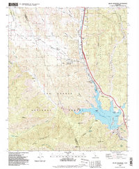
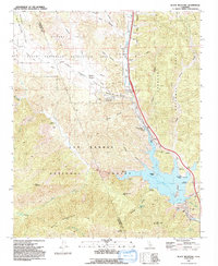
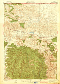
1991 Map of Black Mountain
USGS Topo · Published 1992About this map
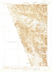
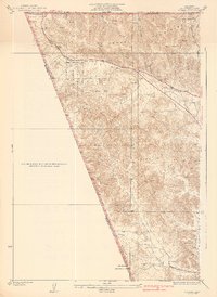
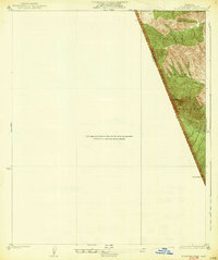
Pyramid Lake dominates the southeastern quadrant of this terrain, where the waters surround Chumash Island and reach into canyons like Posey Canyon. The landscape is a crossroads of conservation and recreation, split between the Los Padres National Forest, Angeles National Forest, and the Hungry Valley State Vehicular Recreation Area. Infrastructure for the California Aqueduct is evident at the William E Warne Power Plant Pumping Sta, reflecting the intensive water management required in this region.
Find a feature on this map
53 named features on this map. Tap any name to fly to it.
Don’t see what you’re looking for? This feature index may not catch every label — zoom into the map to look around manually.
Map Details
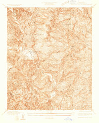
Editions of this 1991 Black Mountain Map
2 editions found
Other maps of this area

1903 · Tejon
USGS Topo · 1:125,000
1932 · Beartrap Canyon
USGS Topo · 1:24,000
1933 · Quail
USGS Topo · 1:24,000
1933 · Gorman
USGS Topo · 1:24,000
1938 · Beartrap Canyon
USGS Topo · 1:24,000
1938 · Gorman
USGS Topo · 1:24,000
1938 · Black Mountain
USGS Topo · 1:24,000
1938 · Quail
USGS Topo · 1:24,000
1942 · Frazier Mountain
USGS Topo · 1:24,000
1943 · Neenach
USGS Topo · 1:62,500