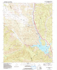
1991 Map of Black Mountain
USGS Topo · Published 1992About this map
Pyramid Lake dominates the southeast corner of this landscape, its waters contained by the spillway and power infrastructure of the William E Warne Power Plant. The map documents a rugged transition between the Los Padres National Forest and Angeles National Forest, where the modern infrastructure of Interstate 5 and the Governor Edmund G Brown California Aqueduct cuts through the steep terrain.
Find a feature on this map
60 named features on this map. Tap any name to fly to it.
Don’t see what you’re looking for? This feature index may not catch every label — zoom into the map to look around manually.
Map Details
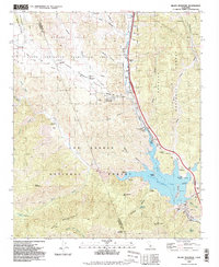
Editions of this 1991 Black Mountain Map
2 editions found
Other maps of this area

1903 · Tejon
USGS Topo · 1:125,000

1932 · Beartrap Canyon
USGS Topo · 1:24,000

1933 · Quail
USGS Topo · 1:24,000

1933 · Gorman
USGS Topo · 1:24,000

1938 · Beartrap Canyon
USGS Topo · 1:24,000

1938 · Gorman
USGS Topo · 1:24,000

1938 · Black Mountain
USGS Topo · 1:24,000

1938 · Quail
USGS Topo · 1:24,000

1942 · Frazier Mountain
USGS Topo · 1:24,000

1943 · Neenach
USGS Topo · 1:62,500