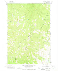
1963 Map of Black Mtn
USGS Topo · Published 1975About this map
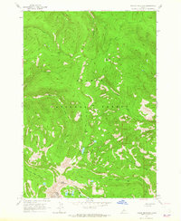
Salmon National Forest and Challis National Forest dominate this high-altitude landscape in central Idaho, where the boundary between Lemhi Co and Custer Co snakes through deep canyons and over prominent peaks. The topography is defined by significant elevations such as Black Mtn and Woods Peak, with drainages like Panther Creek and Morgan Creek carving the terrain. Human presence is sparse, limited to remote sites like the Oyler Ranch and a network of primitive routes, including a Jeep Trail along Alder Creek. The map documents a classic wilderness environment before modern expansion, where seasonal drainages like Annie Rooney Creek and Arrastra Creek provided the only landmarks for travelers. Named features like Van Horn Peak and the secluded Cougar Lake highlight the isolation of this region during the mid-twentieth century.
Find a feature on this map
31 named features on this map. Tap any name to fly to it.
Don’t see what you’re looking for? This feature index may not catch every label — zoom into the map to look around manually.
Map Details
Editions of this 1963 Black Mtn Map
2 editions found
Other maps of this area

1956 · Challis
USGS Topo · 1:62,500

1956 · Twin Peaks
USGS Topo · 1:62,500

1957 · Challis
USGS Topo · 1:250,000

1960 · Challis
USGS Topo · 1:250,000

1963 · Challis
USGS Topo · 1:250,000
1963 · Opal Lake
USGS Topo · 1:24,000
1963 · Duck Creek Point
USGS Topo · 1:24,000
1963 · Black Mtn
USGS Topo · 1:24,000
1963 · Taylor Mountain
USGS Topo · 1:24,000
1963 · Wards Butte
USGS Topo · 1:24,000