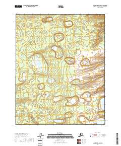
2018 Map of Black River B-6 SW
USGS Topo · Published 2018About this map
Mardow Lake dominates the central-western portion of this Yukon-Koyukuk landscape, serving as a primary hydrologic landmark in an area characterized by intricate wetlands. The map details the Public Land Survey System divisions, including t18n r18e and t17n r18e, providing a precise grid for modern land-use research. This 2018 data illustrates the natural drainage patterns and topographical contours across the northern Alaskan interior, where subtle elevation changes define the distribution of surface water and marshland.
Find a feature on this map
6 named features on this map. Tap any name to fly to it.
Don’t see what you’re looking for? This feature index may not catch every label — zoom into the map to look around manually.
Map Details
Editions of this 2018 Black River B-6 SW Map
This is the sole edition of this map. No revisions or reprints were ever made.
Other maps of this area

1951 · Fort Yukon
USGS Topo · 1:250,000

1951 · Black River
USGS Topo · 1:250,000

1956 · Black River B-6
USGS Topo · 1:63,360

1956 · Fort Yukon B-1
USGS Topo · 1:63,360

1956 · Fort Yukon A-1
USGS Topo · 1:63,360

1956 · Black River A-6
USGS Topo · 1:63,360

1956 · Fort Yukon
USGS Topo · 1:250,000

1956 · Black River
USGS Topo · 1:250,000

1964 · Black River
USGS Topo · 1:250,000
2018 · Black River B-6 NW
USGS Topo · 1:25,000