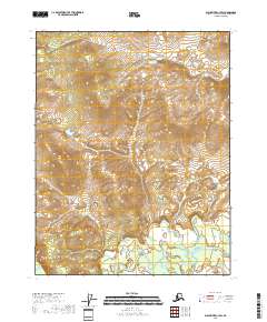
2018 Map of Black River C-3 SW
USGS Topo · Published 2018About this map
The Salmon Fork Black River meanders across the southern reaches of this interior Alaska wilderness, defining the low-lying drainage patterns of the region. This 2018 survey illustrates a landscape dominated by complex topographic relief and isolated water bodies, most notably the uniquely named Cow and Calf Moose Lake in the northern portion of the quadrangle. The map detail highlights the intricate network of townships and ranges, including t21n r25e and t20n r25e, which organize this vast territory within the Yukon-Koyukuk Census Area. Without established roads or settlements, the terrain character is dictated entirely by the natural flow of the river system and the elevation changes of the surrounding uplands, providing a precise record of the hydrological and geological state of the Salmon Fork basin.
Find a feature on this map
10 named features on this map. Tap any name to fly to it.
Don’t see what you’re looking for? This feature index may not catch every label — zoom into the map to look around manually.
Map Details
Editions of this 2018 Black River C-3 SW Map
This is the sole edition of this map. No revisions or reprints were ever made.
Other maps of this area

1951 · Black River
USGS Topo · 1:250,000

1956 · Black River B-3
USGS Topo · 1:63,360

1956 · Black River B-4
USGS Topo · 1:63,360

1956 · Black River C-4
USGS Topo · 1:63,360

1956 · Black River C-3
USGS Topo · 1:63,360

1956 · Black River
USGS Topo · 1:250,000

1964 · Black River
USGS Topo · 1:250,000
2018 · Black River C-3 NW
USGS Topo · 1:25,000
2018 · Black River B-3 NW
USGS Topo · 1:25,000
2018 · Black River C-3 NE
USGS Topo · 1:25,000