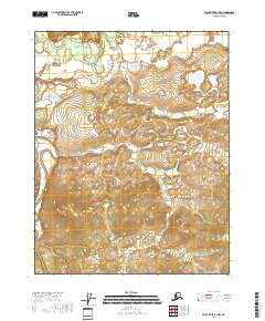
2018 Map of Black River B-3 NW
USGS Topo · Published 2018About this map
The Salmon Fork Black River flows across the northern edge of this Interior Alaska landscape, where the terrain is defined by low-lying wetland systems and the complex drainage of the Draanjik River. This area within the Yukon-Koyukuk region reflects a largely roadless wilderness, characteristic of the Porcupine River basin. To the southwest, a prominent topographical elevation known as The Reef stands out from the surrounding plains, providing a distinctive landmark in an otherwise subtle and winding riverine environment. The map details the Public Land Survey System grid across multiple townships, including t19n r25e and t18n r25e, illustrating how federal land management is organized in this remote part of the state.
Find a feature on this map
9 named features on this map. Tap any name to fly to it.
Don’t see what you’re looking for? This feature index may not catch every label — zoom into the map to look around manually.
Map Details
Editions of this 2018 Black River B-3 NW Map
This is the sole edition of this map. No revisions or reprints were ever made.
Other maps of this area

1951 · Black River
USGS Topo · 1:250,000

1956 · Black River B-3
USGS Topo · 1:63,360

1956 · Black River B-4
USGS Topo · 1:63,360

1956 · Black River C-4
USGS Topo · 1:63,360

1956 · Black River C-3
USGS Topo · 1:63,360

1956 · Black River
USGS Topo · 1:250,000

1964 · Black River
USGS Topo · 1:250,000
2018 · Black River B-3 NE
USGS Topo · 1:25,000
2018 · Black River B-3 SW
USGS Topo · 1:25,000
2018 · Black River B-4 NE
USGS Topo · 1:25,000