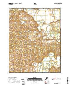
2018 Map of Black River B-4 NE
USGS Topo · Published 2018About this map
The Draanjik River winds extensively across this portion of the Yukon-Koyukuk Census Area, defining a landscape of complex hydrological patterns and low-lying wetlands. Flowing through the eastern and central sections of the quadrangle, the river creates numerous oxbows and secondary channels, most notably in the vicinity of Salmon Slough in the northeast. The topographic data, derived from the U.S. Geological Survey National Elevation Dataset, illustrates the subtle relief of the river basin, where elevation changes are minimal and dictated by the ancient migration of the watercourse. This 2018 survey provides a precise record of the river's path through townships t19n r24e and t18n r24e, serving as a foundational document for understanding the modern geography of this interior Alaskan waterway before future seasonal shifts alter its course.
Find a feature on this map
6 named features on this map. Tap any name to fly to it.
Don’t see what you’re looking for? This feature index may not catch every label — zoom into the map to look around manually.
Map Details
Editions of this 2018 Black River B-4 NE Map
This is the sole edition of this map. No revisions or reprints were ever made.
Other maps of this area

1951 · Black River
USGS Topo · 1:250,000

1956 · Black River B-3
USGS Topo · 1:63,360

1956 · Black River B-4
USGS Topo · 1:63,360

1956 · Black River C-4
USGS Topo · 1:63,360

1956 · Black River C-3
USGS Topo · 1:63,360

1956 · Black River
USGS Topo · 1:250,000

1964 · Black River
USGS Topo · 1:250,000
2018 · Black River B-3 NW
USGS Topo · 1:25,000
2018 · Black River B-3 SW
USGS Topo · 1:25,000
2018 · Black River B-4 SE
USGS Topo · 1:25,000