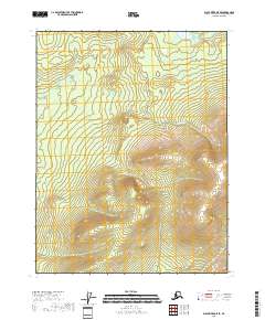
2018 Map of Black River D-5 SE
USGS Topo · Published 2018About this map
Frozen Calf Mtn dominates the southeastern terrain of this remote Yukon-Koyukuk landscape, where elevations rise steeply from the surrounding marshlands. The hydrology is defined by the winding course of Fishhook Cr, which meanders through the northern reaches of the quadrangle, carving through a vast expanse of wetlands and small kettle lakes. This 2018 survey reveals a territory characterized by the Public Land Survey System grids of t24n r21e, t23n r21e, and surrounding townships, illustrating a landscape largely untouched by modern road infrastructure or permanent settlements. The topographical data, derived from the National Elevation Dataset, highlights the isolated peaks and drainage patterns that dictate the movement of water toward the Black River system beyond these borders.
Find a feature on this map
8 named features on this map. Tap any name to fly to it.
Don’t see what you’re looking for? This feature index may not catch every label — zoom into the map to look around manually.
Map Details
Editions of this 2018 Black River D-5 SE Map
This is the sole edition of this map. No revisions or reprints were ever made.
Other maps of this area

1951 · Black River
USGS Topo · 1:250,000

1956 · Black River D-4
USGS Topo · 1:63,360

1956 · Black River D-5
USGS Topo · 1:63,360

1956 · Black River C-5
USGS Topo · 1:63,360

1956 · Black River C-4
USGS Topo · 1:63,360

1956 · Black River
USGS Topo · 1:250,000

1964 · Black River
USGS Topo · 1:250,000
2018 · Black River C-4 NW
USGS Topo · 1:25,000
2018 · Black River D-4 SW
USGS Topo · 1:25,000
2018 · Black River C-5 NE
USGS Topo · 1:25,000