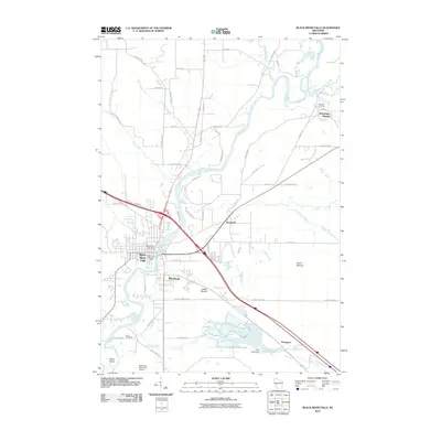
2010 Map of Black River Falls
USGS Topo · Published 2010About this map
The Black River carves a deep path through Jackson County, serving as the central artery for Black River Falls. This modern survey illustrates the persistent importance of river management, featuring the Black River Falls Dam near the city center and the Perry Creek Dam to the south. The landscape is punctuated by geological landmarks like Castle Mound and Silver Mound, while the southern reaches of the map are defined by the expansive Cranberry Flowage, a clear indicator of the region's agricultural specialized water usage.
Find a feature on this map
63 named features on this map. Tap any name to fly to it.
Don’t see what you’re looking for? This feature index may not catch every label — zoom into the map to look around manually.
Map Details
Editions of this 2010 Black River Falls Map
This is the sole edition of this map. No revisions or reprints were ever made.
Other maps of this area

1924 · Black River Falls
USGS Topo · 1:62,500

1926 · Black River Falls
USGS Topo · 1:62,500

1928 · Melrose
USGS Topo · 1:48,000

1947 · Millston
USGS Topo · 1:62,500

1949 · Millston
USGS Topo · 1:62,500

1949 · Melrose
USGS Topo · 1:62,500

1953 · Eau Claire
USGS Topo · 1:250,000

1958 · Eau Claire
USGS Topo · 1:250,000

1958 · Hatfield
USGS Topo · 1:48,000

1964 · Eau Claire
USGS Topo · 1:250,000