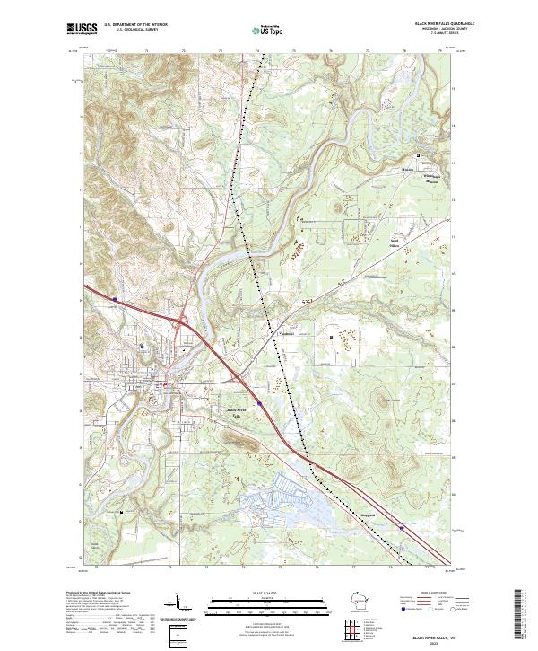
2023 Map of Black River Falls
USGS Topo · Published 2023About this map
The Black River Falls area serves as a central hub in Jackson County, where the Black River and the Black River Flowage dominate the physical and economic landscape. This 2023 survey highlights the modern infrastructure of the city, including the Jackson County Courthouse and the Western Technical College Black River Falls Campus, while also preserving the locations of long-standing community sites like Riverside Cem. The map illustrates a unique cultural geography, specifically the presence of the Winnebago Mission, Mission, and Sand Pillow settlements, which are connected by a network of roads with culturally significant names such as Wa Ka Ja Junk Rd and Big-Bison-Bull-St. To the east and south, the terrain rises at Silver Mound and Castle Mound, offering a contrast to the river valley where numerous tributaries like Levis Creek and Perry Creek converge.
Find a feature on this map
139 named features on this map. Tap any name to fly to it.
Don’t see what you’re looking for? This feature index may not catch every label — zoom into the map to look around manually.
Map Details
Editions of this 2023 Black River Falls Map
This is the sole edition of this map. No revisions or reprints were ever made.
Other maps of this area

1924 · Black River Falls
USGS Topo · 1:62,500

1926 · Black River Falls
USGS Topo · 1:62,500

1928 · Melrose
USGS Topo · 1:48,000

1947 · Millston
USGS Topo · 1:62,500

1949 · Millston
USGS Topo · 1:62,500

1949 · Melrose
USGS Topo · 1:62,500

1953 · Eau Claire
USGS Topo · 1:250,000

1958 · Eau Claire
USGS Topo · 1:250,000

1958 · Hatfield
USGS Topo · 1:48,000

1964 · Eau Claire
USGS Topo · 1:250,000