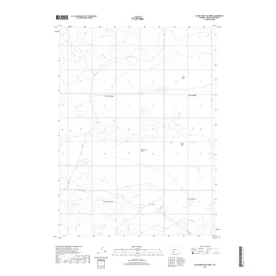
2017 Map of Black Rock Flat West
USGS Topo · Published 2017About this map
Alkali Basin and the broad expanse of Black Rock Flat characterize this high-desert terrain in the northeastern reaches of the county. The landscape is defined by its drainage patterns, notably where Greasewood Wash cuts through the central sections and Black Rock Cr meanders across the southern portions of the quadrangle. This 2017 survey reflects the contemporary logistical framework of the region, anchored by established routes like Bitter Creek Rd and Co Rd 15. These roads, alongside Co Rd 4-19, provide the primary access to the vast open range and seasonal watercourses. The map serves as a precise record of the Public Land Survey System (PLSS) divisions, illustrating the township and range lines that govern land management in this remote Wyoming corridor.
Find a feature on this map
11 named features on this map. Tap any name to fly to it.
Don’t see what you’re looking for? This feature index may not catch every label — zoom into the map to look around manually.
Map Details
Editions of this 2017 Black Rock Flat West Map
This is the sole edition of this map. No revisions or reprints were ever made.
Other maps of this area

1954 · Rock Springs
USGS Topo · 1:250,000

1955 · Lander
USGS Topo · 1:250,000

1958 · Lander
USGS Topo · 1:250,000

1958 · Rock Springs
USGS Topo · 1:250,000

1958 · Twelvemile Well
USGS Topo · 1:62,500

1958 · Freighter Gap
USGS Topo · 1:62,500

1958 · The Pinnacles
USGS Topo · 1:62,500

1958 · Superior
USGS Topo · 1:62,500

1961 · Lander
USGS Topo · 1:250,000

1962 · Rock Springs
USGS Topo · 1:250,000