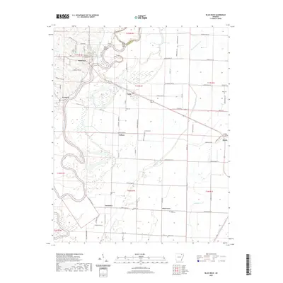
2020 Map of Black Rock
USGS Topo · Published 2020About this map
The Black River winds through this corner of Lawrence County, defining the landscape between the settlements of Black Rock and Powhatan. This 2020 survey illustrates a region where the waterway's meanders create distinct geographic features like Box Factory Bend and Portia Bay. The map captures a transition from the elevated street grids of Portia and the rail-oriented layout of Hoxie to the expansive wetlands and bottomlands surrounding Swan Pond and Clear Lake.
Find a feature on this map
66 named features on this map. Tap any name to fly to it.
Don’t see what you’re looking for? This feature index may not catch every label — zoom into the map to look around manually.
Map Details
Editions of this 2020 Black Rock Map
This is the sole edition of this map. No revisions or reprints were ever made.
Other maps of this area

1932 · Walnut Ridge
USGS Topo · 1:62,500

1934 · Powhatan
USGS Topo · 1:62,500

1935 · Powhatan
USGS Topo · 1:62,500

1935 · Sedgwick
USGS Topo · 1:62,500

1935 · Alicia
USGS Topo · 1:62,500

1935 · Walnut Ridge
USGS Topo · 1:62,500

1953 · Memphis
USGS Topo · 1:250,000

1956 · Memphis
USGS Topo · 1:250,000

1957 · Poplar Bluff
USGS Topo · 1:250,000

1959 · Poplar Bluff
USGS Topo · 1:250,000