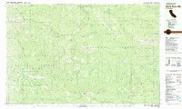
1981 Map of Black Rock Mtn
USGS Topo · Published 1981About this map
Six Rivers National Forest and Trinity National Forest converge in this high-altitude landscape of Trinity County, where narrow ridges and deep gulches define the topography. The 1981 survey reveals a territory primarily managed for natural resources, featuring the Bonanza Mine and Lucky Sunday Mine tucked into the steep slopes of Van Horn Ridge. The presence of these operations alongside the Lookout Tower on a prominent peak illustrates the dual history of extraction and forest management in the region.
Find a feature on this map
55 named features on this map. Tap any name to fly to it.
Don’t see what you’re looking for? This feature index may not catch every label — zoom into the map to look around manually.
Map Details
Editions of this 1981 Black Rock Mtn Map
This is the sole edition of this map. No revisions or reprints were ever made.
Other maps of this area

1890 · Red Bluff
USGS Topo · 1:250,000

1894 · Red Bluff
USGS Topo · 1:250,000

1918 · Anada
USGS Topo · 1:62,500

1921 · Hoaglin
USGS Topo · 1:62,500

1922 · Island Mountain
USGS Topo · 1:62,500

1931 · Hoaglin
USGS Topo · 1:96,000

1935 · Hoaglin
USGS Topo · 1:125,000

1951 · Chanchelulla Peak
USGS Topo · 1:62,500

1953 · Blackrock Mtn
USGS Topo · 1:62,500

1954 · Pickett Peak
USGS Topo · 1:62,500